
Dji Terra
DJI Terra
Make the World your Digital Asset
DJI Terra is 3D model reconstruction software that has photogrammetry as its core technology. It supports a range of accurate and efficient 2D and 3D reconstruction of visible light, and data processing through DJI LiDAR. DJI Terra is a perfect match for DJI Enterprise drones and payloads. It works in conjunction to build a complete application solution that caters to verticals such as land surveying and mapping, power transmission, emergency services, construction, transportation, and agriculture.
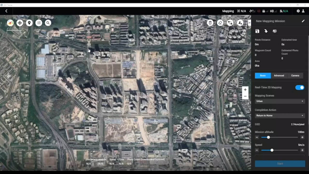
Area Mapping
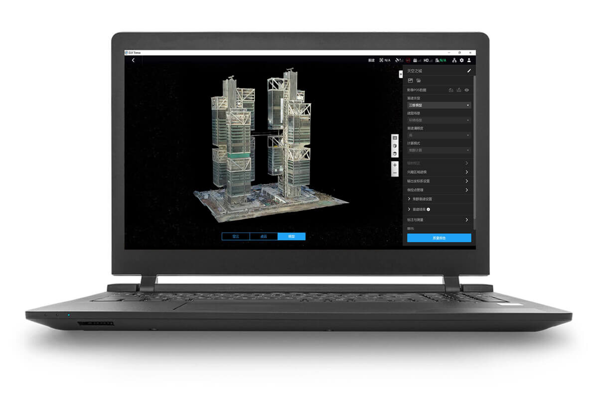
3D Models
Realistic 3D models can be generated in three resolutions—high, medium and low. Water surfaces in the model are automatically optimized through AI technology, and the formats commonly used in the industry are exported for image reconstruction in diverse scenarios, such as surveying and mapping, accident sites, power grid equipment, and progress-tracking for construction projects.
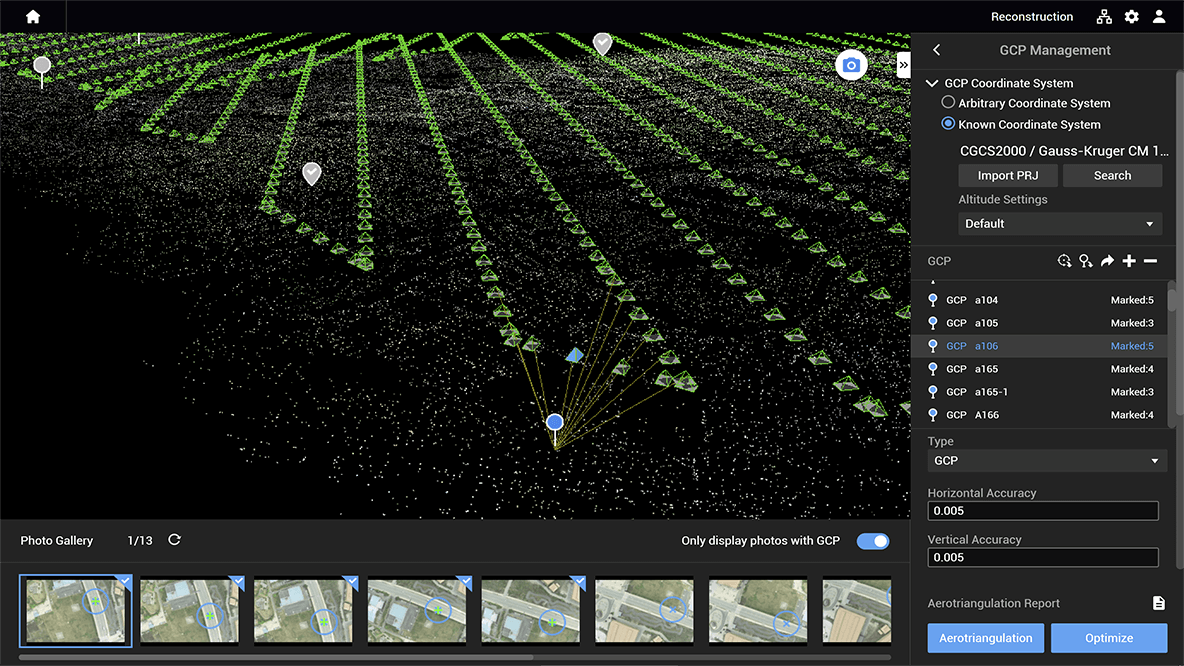
2D Maps
The algorithm is optimized according to the different scenarios to significantly improve processing efficiency, effectively avoid image warping and deformation, and obtain detailed and accurate measurement results for all your target objects and survey areas.
LiDAR
With just one click, you can perform highly accurate processing of the point cloud data captured by the Zenmuse LiDAR in DJI Terra, including route calculation, precise fusion of point cloud and visible light data, optimization of point cloud accuracy, ground point extraction, DEM generation, and mission report output.
Multispectral
Dji Terra and Dji Modify Seamless Workflow
With one click, DJI Terra can launch DJI Modify. DJI Terra can also easily generate files for model editing with another click. These simple steps make the subsequent model editing process quick and convenient. DJI Modify is DJI’s first intelligent 3D model editing software. It features a streamlined and intuitive interface that is simple to use to complete 3D model editing efficiently. It accurately identifies floating parts, holes, and vehicles in the models. Mesh can be repaired with a single click, with true-to-life textures generated quickly, significantly simplifying the model editing process. Paired with a DJI Enterprise drone and DJI Terra, it forms a comprehensive solution from aerial surveying, modelling, and model editing to sharing these models easily to meet operational needs in surveying and mapping, firefighting, emergency response, and transportation.